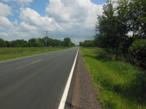
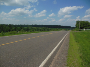
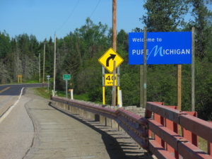
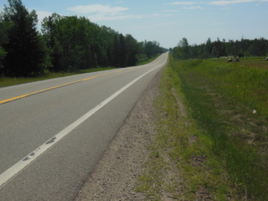
Fergus Falls, MN to Melrose, MN; 76 miles, mostly cloudy, SE 10+ mph headwind, 70-80’s

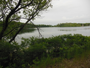
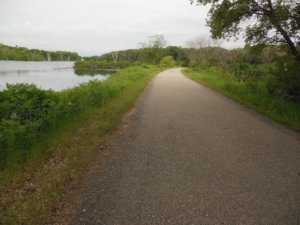
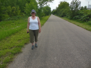
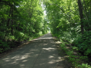
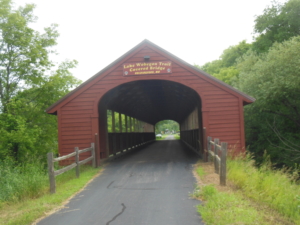
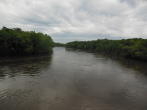
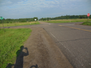
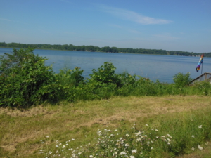
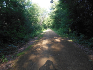
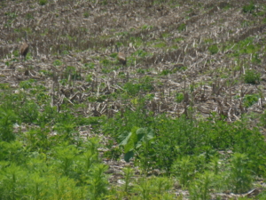
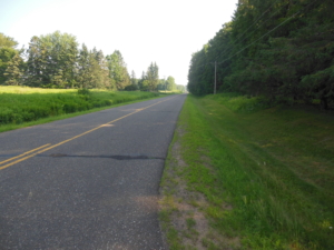
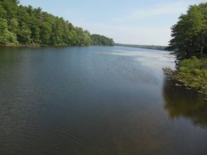
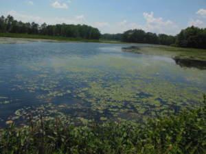
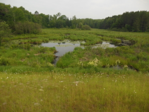
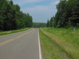
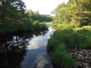
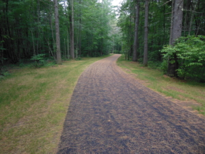
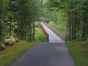
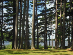
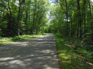
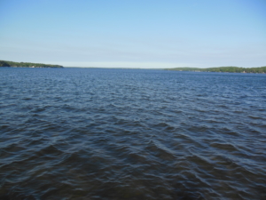
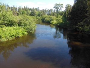
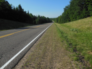
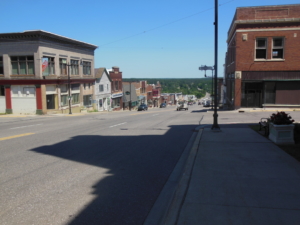
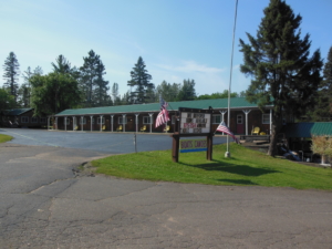
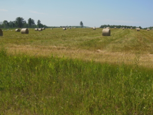
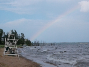
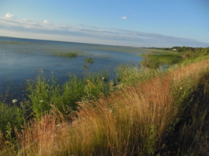
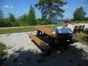
Today I set a personal record for the longest continuous bike ride on a paved bike trail. It wasn’t hard figuring out where to go. The trail pavement conditions were mainly fair to good. The trail went through several small towns spaced out by 8-12 miles so services were readily available. Each town had a small parking area, open picnic shelter, and porta-potty. Bike/walker/runner traffic was busiest near the larger towns. At one point I passed a line of young day campers and their counselors out for a ride. I politely taught them the meaning of ride right. The trail crossed open farm lands and the occasional shaded woods. The latter was a welcome change from the last couple of weeks of open prairie. This being the land of 10,000 lakes, there were several along the route as well. I recommend the MN bike trail system to any of you readers who enjoy riding bike trails. We decided not to ride tomorrow on the 4th, so we will see what small town celebrations we can find.


Melrose, MN to Milaca, MN; 76 miles, mostly cloudy, winds 10 mph NE, and 70’s

Yesterday we celebrated the 4th by doing laundry and then basically doing nothing by hanging out for awhile at Birch Lake at a state forest access site. We had a nice conversation with a local couple there and learned more about life in the area. No fireworks shows were held nearby so a quiet evening with ice cream at DQ.

Today it was back to riding. Rain was forecast for the afternoon so I had an early start right from the motel. I finished the bike trail portion of the ride with another 27 miles of great trail riding, much through old railroad cuts in wooded areas. There were many squirrels doing their best to get run over. Every cross country ride needs to ride across at least one covered bridge. The one in the photo was on the trail so check that off. Finally it was back to the roads after 104 miles of trails. We crossed the Mississippi River. It is always a key milestone to be east of the Mississippi. The county roads were for the most part in good condition with shoulders when it mattered and very light traffic. So we made good time and beat the rain to our destination town.


Milaca, MN to Osceola, WI; 73 miles, sunny, winds 5-10 N, 70-80’s

Today’s ride continued to follow a series of MN county roads in a generally southeastern direction to cross the St, Croix River into our next state of Wisconsin. The St Croix is a National Scenic River and there were lot’s of people on the water where we crossed. The ride was pretty routine with a gentle roll at times to make it more interesting. Occasionally the route passed one of the 10,000 lakes. The photo is of lake #4367. We had lunch in a nice cafe in Harris, MN just after crossing I-35. There was a backup due to construction on I-35 so many people were bailing to detour around the backup through Harris that made biking more difficult that it normally would have been. I crossed paths with a self supported touring couple from the Netherlands heading west. They started in Boston and are following the northern route I will be using. She of course pointed out that the Netherlands will be playing the US in the Women’s World Cup soccer final. Looking ahead our route leaves the Northern Tier route we have been following since WA and begins  the “North Lakes” route that will take us across northern WI and the Upper Peninsula of MI.


Osceola, WI to Haugen, WI; 67 miles, sunny, 5-10 mph S wind, 70-80’s

Wisconsin is different from MN just across the river. The roads are much more rolling and as we left the St. Croix River behind, the land transitioned to a 50-50 mix of farms and forests. There was a nice stone dust trail, the Gandy Dancer Trail, for about six miles early in the ride. The rest of today’s ride followed various county roads. Some were lightly traveled, others were quite busy with a mix of local vehicles and lake cottage country traffic. We had to detour around a car show event that blocked the main street of Balsam Lake. We lunched in the town of Cumberland. US 63 is a main highway that goes through town with it’s one stop light. This being the last day of the long holiday there was a long steady stream of cars going through town as people head south back to the cities. The wildlife highlight for the day was having two Sandhill Cranes fly across the road in front of me and land in a field next to the road. (An eye test – see if you can find them in the photo of the corn stubble.) Their calls are a weird kind of clack. The wildlife lowlight was discovering those pesky deer flies ( the big ones with stripped bodies that like to get in your hair and ears) can stay up with you at 13 mph to buzz around looking for a sneak attack. Not fair. And to add a little spice, two large black dogs gave halfhearted chase. This is the first real dog encounter for the entire trip so far, and it wasn’t that close.


Haugen, WI to Moose Lake, WI; 69 miles, sunny, 5-10 S wind, 70-80’s

First a brief note about our improved social life. We have not seen anyone we know since leaving Seattle where we were hosted by Sally’s nephew Kurt and family the day before we started the ride. Last night we had dinner with Kathy and Herb in Rice Lake. Kathy is a high school classmate of Sally. They have a cabin on a lake we passed by today. They were returning home to the Twin Cities after spending the weekend up north and stopped on their way to meet us for dinner. They hosted us at their cabin back in 2012 when I skied the Birkie cross country ski race in Hayward. We enjoyed seeing them and catching up.

Today’s ride was a tour of lake country mainly in the forest. The roads and scenery reminded me of riding in the western Adirondacks. The terrain was rolling/hilly. I am not sure where the dividing line is between the two but there were long shallow hills and steep short hills. It was nice being surrounded by forest again and some of the roads were quite fun to ride. Many of the lakes are surrounded by vacation “cabins”. Some of them are quite large and expensive looking from the road. The route went in and out of an Indian Reservation and a National Forest. We are staying in Hayward tonight as it is the largest town around. As we continue east the region is less populated so it’s possible I might miss a day or so if we do not have Internet coverage.


Moose Lake, WI to Mercer, WI; 72 miles, 10-15+ mph S, sunny, 70-80’s

Today’s route combined state highways and county roads. The first 30 miles or so were on WI 77 through the Chequamegon National Forest. It was good riding with smooth pavement, nice rolling hills, little traffic, and a nice tail wind. There was a 16 mile stretch where there were warning signs for elk crossings. Doing my research, in 1995 elk were reintroduced into the national forest and currently number around 185. The warning signs are the kind that start blinking if the sensors detect movement. The engineers did not consider all test cases, since I seemed to be setting them off as I rode along, and I certainly did not see any elk. However, the SAG driver (Sally) was much more successful as she saw an elk along a side road she was exploring. I keep hoping for a bear sighting on one of the county roads but no luck so far. In case you are wondering as I was, are there any moose in WI, the answer is yes but only about 50 or so. A few logging trucks started to appear, the first we have seen since leaving the mountains of the West. The county roads keep you on your toes as the pavement quality varies widely, and there may be a steep hill to climb just around the next curve.


Mercer, WI to Conover, WI; 60 miles, sunny, 10+ winds NW, 70-80’s

Today’s ride  started out on a nice bike trail out of Mercer along US 51. It connected to the “Heart of Vilas Co. Bike Trail” except I didn’t right away. I missed the turn and rode on a trail that was the plausible correct route until it wasn’t. I actually had to break down and get out my phone to figure out where in heck I was. After backtracking and finally getting back on the correct trail, it was a very nice ride. The trail must be fairly new with good pavement, signage, and cool bridges. Lot’s of people were riding as the area has numerous lakes and is a tourist center. In my defense, one critical sign was missing to point out the turn I missed. After the bike path, the route turned onto County K which was designated as a “Rustic Route”. That translates into a low traffic quiet ride on mostly good pavement through the forest past the occasional lake populated with “cabins” and “resorts”.  Towards the end of the ride I met up with a young touring couple heading west on the route I have and will be following. We had a nice chat comparing notes about the ride ahead. The town of Conover where we stopped is a decision point, go south and take a ferry across Lake Michigan, or continue east to the MI Upper Peninsula and Mackinaw.  We will be doing the latter.


Conover, WI to the Michigamme River, MI; 63 miles, sunny, 10-15 mph N, and 50-70’s

The weather was 10 degrees cooler today so great weather for biking. The route continued east on county roads until we crossed the Brule River and entered Michigan. But Wisconsin had one last surprise (no not one of those Wisconsin Badgers) as a black bear galloped across the road about 200 yards ahead of me earlier in the morning. Now we need to see a moose. I think there is a better chance in the UP (Upper Peninsula). As we have all noticed, when you cross a state line there are differences. When you are biking you tend to focus on things like the pavement quality, signage, the terrain, the availability of services, and the traffic. It was immediately obvious that in Michigan so far the roads are rougher, more densely populated, and definitely hillier than WI. But strangely, there were no flies buzzing around my head, they all seemed to stay in WI. Curious. We shall see what tomorrow brings. We passed through the town of Crystal Falls, MI late in the ride. The photo loses the perspective of looking down the steep hill on main street toward the hill climb as the road leaves town. We stay in a variety of places, ranging from chains to mom and pop motels. We prefer the latter. Tonight we are staying in a motel/fishing camp a few miles east of Crystal Falls on the Michigamme River.


Michigamme River, MI to Wells, MI; 73 miles, sunny, 10 mph SW, 50-70’s

Today’s ride was back on a more major road, state road M-69. The first 15 miles were somewhat busy, especially with full and empty logging trucks. They thinned out once I passed the Louisiana Pacific pulp plant. However, at least one loaded truck went flying past the plant, and in general loaded trucks seemed to come and go somewhat randomly. While the shoulder was somewhat narrow, the pavement was good, and there were only moderate rollers. So I could make pretty good time and distance until we reached Escanaba and Little Bay de Noc, which is a sub-bay of Green Bay, which is part of Lake Michigan. Wells is just east of Escanaba. Otherwise, there was nothing particularly noteworthy about the ride, other than we crossed into the Eastern Time Zone and reached the Great Lakes. And yes, Lake Michigan is high just like Lake Ontario. The three photos sum up the extent of the scenery today.


Wells. MI to Gulliver, MI; 78 miles, sunny 10-20 NW mostly tailwind, 60-70’s

We became reacquainted with US 2 today. If you have been a consistent reader of the blog and have a good memory, you will remember that we rode US 2 in Montana for days. US 2 more or less parallels the Lake Michigan shoreline between Escanaba and Mackinac our next destination. The ride started out on a very nice new bike trail out of Wells and then followed some parallel side roads. At about 10 miles the route joined US 2. It follows the lake shore or cuts across the forest between bays. As US 2 is the major east-west highway along the lake it has a high volume of “recreational and commercial” traffic as the map says. I can verify that by experience today. The good news is that it has a wide shoulder. Two observations about riding along a busy highway. You always need to be alert  to the traffic of course, but you also need to watch where you are going to avoid the shoulder debris; stones, chunks of dead tires, hunks of wood off logging trucks, road kill in various stages of decomposition, and miscellaneous stuff like bolts and random hunks of unidentifiable metal. I wonder, where do all these parts come from, and does it matter that they’re lying in the road instead of where they came from. You do not hear the sounds of nature such as bird songs as was true on low traffic county roads unless there is a temporary lull in the action. Instead it is the whoosh of wind as vehicles pass including a little push when semi-trucks pass, the roar of engines, and the sizzle of tires on the pavement. Tonight we are staying in the “Dreamland Motel” that is not close to anything, and that has an attached restaurant and bakery. Perfect.