Charlevoix, MI to Bingham, MI; 70 miles, sunny, 10-15 mph SW, 60-80’s
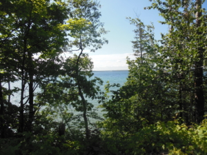
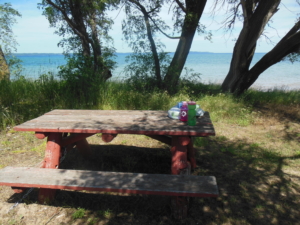
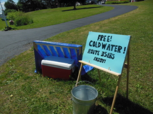
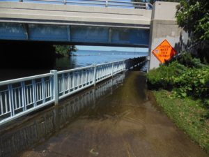
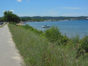
The route today followed back roads when available with short stretches on US 31. US 31 is also known historically as the “Dixie Highway”, because it was developed in the early 20th century to connect the Midwest with the South. There was a lot of variety in the riding. Some roads were hilly in farms and orchards. This is prime cherry growing territory and the trees are loaded with ripe red cherries. Some roads were more flat in the trees along Lake Michigan or Torch Lake with frequent lake side homes. We had lunch at a great picnic area next to the water. After lunch I came upon some “road magic” of a cooler of cold water, like trail magic on the Appalachian Trail. My route follows the US 35 Bike Route that explains the sign. This is the first time on this trip or my earlier cross county trip that I have encountered such a thing. As we neared Traverse City the route followed the “TART” bike trail through the city. It was a little confusing at times to discern where the trail was going. I have personal evidence that indeed Lake Michigan is as high as Lake Ontario above long term averages. It is not fake news. The bike path goes under US 31 along a canal in the city. The path was 2-3″ underwater due to the high water. No problem for my high water bike. Sally and I met up not long after that by a small beach just north of the city. By then it was hot so I got a short swim in. It was cold but refreshing. I finished the day after the swim with another 10 mile on the bike trail.