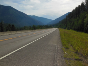
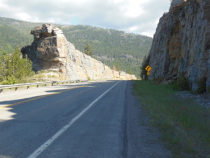
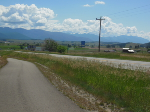
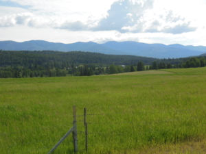
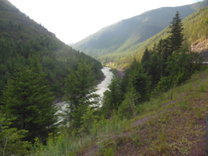
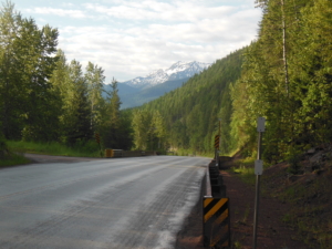
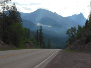
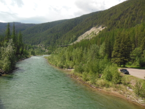
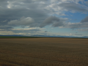
Cabinet Range view point on MT 56 to Koocanusa Lodge, 61 miles, sunny 60-90’s

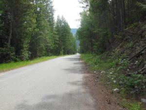
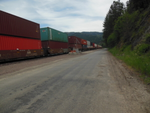
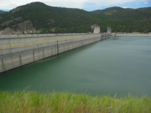
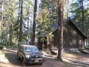
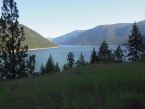
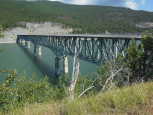
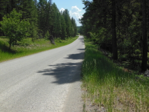
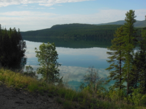
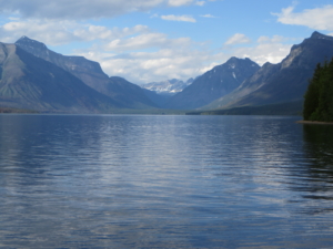
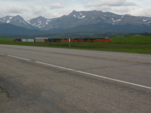
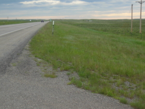
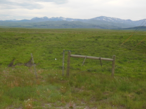
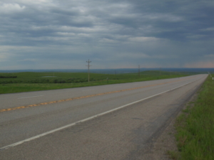
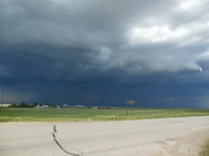
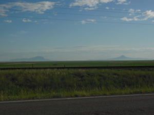
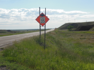
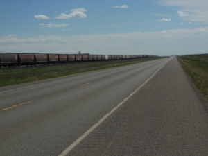
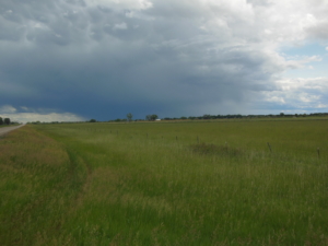
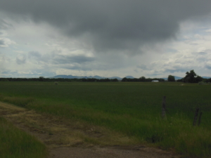
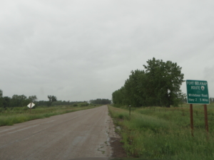
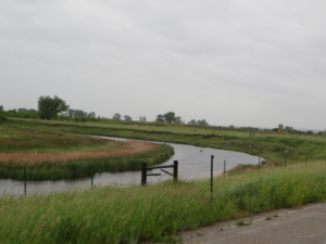
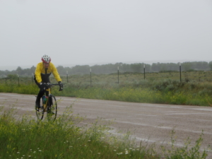
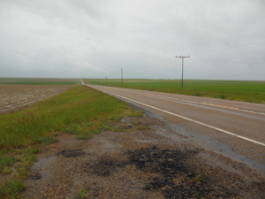
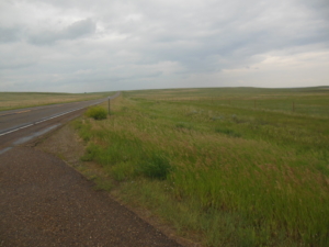
The route today went through just one town, Libby MT. Libby was our lunch spot at the town park. The rest of the route followed highways and back roads in fairly remote areas with no services or even many residences. Only one 500′ climb but at the end of day when it was hot. It has been in the high 80’s pushing 90 in the afternoons. (Sorry about all that rain in the ROC.) For awhile the route followed a major rail line so the occasional train provided some entertainment. Hundreds of containers from China and Korea judging by the names. Life is simple on the road.  Also we finally saw two other loaded cyclists on the route today so I am not the only one pursuing this endeavor. The last part of the route paralleled Lake Koocanusa which is a reservoir behind a dam of the Koocanusa River. The route will follow it for another 35 miles,  Luckily in this remote area there was a lodge just off the route at the right distance I wanted to cover. We are in Cabin #8 at the Lake Koocanusa Resort. And they have a restaurant! But there is no Internet so this will be posted tomorrow.

In other news, Denise from Woman Tours ( a Rochester company) is scouting the route for a future trip. She was in the group with Sally when Sally rode cross country in 2006. She knew were we riding and caught up with us today for a short chat.


Koocanusa Lodge to Fortine, MT;  60 miles, sunny with scattered afternoon thundershowers, 60-70’s

Today’s route followed MT State Route 37 for 40 miles along Lake Koocanusa to the town of Eureka and then on to the small town of Fortine. We are staying in Eureka. There were afternoon thundershowers in the area but they missed me while riding. Just a few claps of thunder in the distance. Today was an exercise of going up a few hundred feet and then going down, and repeat. I lost track of how many times. For fun I mapped the route to learn I climbed 4300 feet. Not a bad day’s work. I have been cautious on the descents. The shoulders of major highways in MT have rumble strips about a foot into the shoulder that leaves about two feet of clear shoulder. The shoulders tend to be “dirty” with small stones and chunks of wood from the logging trucks. While there is light traffic, riding in the driving lane is risky unless there is a clear sight line. So unfortunately, you can’t always let it rip.


Fortine, MT to West Glacier, MT; 69 miles, sunny, brief afternoon shower, 70’s high

The route today followed US Highway 93 for 30 miles or so to Whitefish, MT with one stretch of delightful side road through flattish range and farm land. 93 is a heavily traveled road but on a Saturday there was less traffic and no semi-trucks. The shoulder is narrow but adequate in most places. However, there was one stretch just before Whitefish that is hilly, curvy, rough, and without a shoulder. I hope this was the worst stretch of road on the trip not to be repeated. Just before West Glacier the route included 2-3 miles of gravel not suited to my skinny road bike tires. I was ferried across it. Now for you naysayers who will claim I didn’t do the whole distance, my response is that it’s my ride and I can make the rules! No different than taking a ferry across a body of water in my opinion.

After dinner, we drove as far as you can into Glacier Park and did a short hike. The Going-to-the-Sun highway is closed before Logan Pass as they are still removing snow. It makes my decision to take the alternative route over the much easier Marias Pass guilt free.

We have now met some fellow bikers. A father and his seven year old son who is riding his own bike. They started from Seattle. A solo rider from Picton, ON who is self sustained and riding as far as Minneapolis. And finally a couple from Seattle who are riding to Boston.

West Glacier, MT to East Glacier, MT; 57 miles, mostly cloudy, 50-60’s

Today’s route followed US Highway 2 over the Continental Divide at Marias Pass at 5216′. If you read yesterday’s blog post you might remember I called it easier than Logan Pass in Glacier NP. Easier turned out to be relative. While the net elevation gain was roughly 2000′, the actual climbing elevation gain over the 43 miles to the pass was 5500′. Let’s just say that I am tired tonight. RT 2 carried more traffic than I expected. I think much of it was local people returning from their weekend camping trips at the end of the weekend. Part way up was the town of Essex. We smartly met there at 9:30 and had a nice breakfast at the Izaak Walton Inn just off the route. I started at 7 after a first breakfast of a banana and those little powdered donuts you can buy at convenience stores. Not enough, so breakfast number two saved my bacon so to speak. I sometimes find it hard to eat enough while riding. Tonight we are staying in East Glacier and had dinner at the Glacier Park Lodge on the other side of the tracks. Earlier I had an Indian Taco at a local Indian run stand as a snack. It is a taco with Indian flat bread. Tomorrow is a needed zero mile rest day and we will visit Glacier NP. The mountain passes are now behind us as we begin the long trek across the great plains. It is all down hill from here!


East Glacier, MT;  0 miles, partly cloudy 60’s

Today was a rest day so we toured Glacier NP and did some short trail walks. Wildlife sightings included a moose and a herd of mountain sheep. We had dinner tonight in a great Mexican restaurant called Serrano’s just around the corner. We invited a young German woman to join us at dinner who has been hiking the Continental Divide Trail. She made it as far as Colorado before snow stopped her. She hitched up here to try going south from Canada. I think she will run into the same problem going south. Some photos from today.

East Glacier to Shelby, MT; 72 miles, sunny, tailwind, then a PM storm

Today’s weather was a tale of two extremes. The ride started in fair weather with a 10-15 mph tailwind. The route will follow US RT 2 for several days. The terrain is gently rolling plains. What a contrast to the last two weeks of forests and mountains. The road has varying width shoulders with the danged rumble strips near the traffic lane. The traffic itself is light. All and all the AM went well to arrive in Cut Bank, MT after 47 miles.  Looking back you could see the mountains disappearing in the mirror. After a quick lunch the goal was to ride another 24 miles to reach Shelby for the overnight. Scattered storms were predicted and there was one off in the distance that didn’t look too threatening. Well, said storm caught up with me about 6 miles from Shelby with no shelter of any kind for miles. Wind and rain of course, a few lightening flashes, but the worst was hail. I was pelted with hail big enough to raise welts on my back and a lump on my head as I bent over after stopping to protect myself. Fortunately a guy stopped and let me get in his car until the worst was over. We learned our lesson, the SAG driver needs to stay closer when there is threatening weather. The storms out here don’t mess around.


Shelby, MT to Kremlin, MT; 78 miles, partly cloudy, 50-70’s, strong tailwind

Wonderful tailwind all day today, this west to east thing is working out well so far (I know sooner or later there will be headwind). The ride continued east across the plains. There are some cattle ranches but now we are seeing vast wheat fields, some planted, some fallow. There are little towns about every 10 miles or so to mark progress. I saw one pronghorn antelope prance across the road in front. Very low traffic at first but it picked up after noon. Another ferry was required to get through nine miles of road construction gravel and mud. I did a lot of coasting today, as the elevation slowly drops. The small complaint I have is the shoulder width varies from wide and rideable to narrow with the ever present rumble strip. The latter is essentially unrideable so one must ride along the white line. We are staying in Havre tonight, the nearest town with any services. The ride will resume tomorrow in Kremlin, 18 miles west. The last photo was taken at our lunch spot in Chester, MT.


Kremlin, MT to Harlem, MT; 62 miles, mostly cloudy, head/tail winds, light afternoon shower, 40-50’s

A cold front came through last night so cooler temperatures. Snow in the mountains so we dodged that bullet. Today’s route for the most part was FLAT along the Milk River valley. There are some trees so it actually looks like Iowa river bottoms in some ways for you RAGBRAI veterans. As you may have noticed the route is paralleled by the BNSF rail line. There are constant freight trains passing to provide entertainment. Amtrak also uses the line. Lower mileage today because I actually had to pedal all day instead of those welcome free miles of coasting downhill. We are staying tonight in Chinook, MT. The distance between towns with overnight accommodations don’t nicely align with the distance I want to cover each day so we do the shuttle to and from end/start points.


Harlem, MT to Wagner, MT; 42 miles, rain, wind, and 40’s

Today was not a great weather day. In fact it made me homesick for Rochester weather in early April. We were confronted with a good old fashioned low pressure Northeaster. Light to moderate rain at first that became heavier midday. Light wind out of the NW at first growing to 25 MPH with higher gusts. Not much to block it around here. For awhile it was okay riding with the tailwind. I layered up with all of my rain and cycling gear and was wet but warm enough. However, as the shoulder narrowed and the wind gusts increased we decided to abandon the ride 8 miles short of our goal of Malta, MT where we are staying. It didn’t seem prudent to keep riding in those conditions as the wind surge of passing large trucks threatened to knock me off the road. The forecast calls for more rain tomorrow so we shall see how much forward progress we can make. Photo credits to the SAG driver, I wasn’t in the mood.

We had one of those road experiences that you can only get cycle touring. Lunch time is usually around 10:30-11:00. Sally found a store in Dodson, MT and talked the elderly owner into keeping the store open for us. He was very gracious to let us bring the bike in and dry off, and eat our lunch with some drinks we bought from him. It’s Friday so we will be having prime rib for dinner tonight. We have Friday fish fry in NY, in MT they have prime rib.


Wagner, MT to Glasgow, MT; 80 miles, rain, NW winds 15-20 mph, 50’s

The good news is there was a strong tailwind all day. The bad news is it rained almost all day and I had not one but two flats. Those little stones on wet shoulders are the problem. Plus it is past time to put on new tires. Further the first flat was between towns and my bike pump failed so I had to SOS my SAG driver for assistance. However, that led to a pleasant experience of lunch in a very nice cafe run by a very nice lady in the town of  Hindsdale.  The second flat was in the overnight town of Glasgow so no big deal. It turns out that Galsgow is close enough to the Williston, ND oil patch that we had a little trouble finding a place to stay. I will be doing bike maintenance tonight; tires, clean, and lub. And a new pump was purchased in Glasgow.